

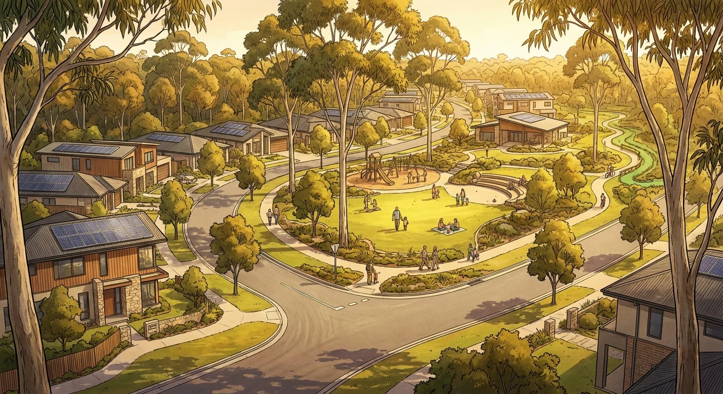
Welcome to Wilton Greens: A New Era of Community Living
If you are tracking the rapid expansion of Sydney’s South West, Wilton Greens stands out as a focal point of this massive urban shift. Located within the Wollondilly Shire, this master-planned community is designed to balance the convenience of modern suburban infrastructure with the natural beauty of the surrounding Macarthur region. The core philosophy behind the development is to create a self-sustaining ecosystem where residents have immediate access to transport corridors, educational facilities, and essential retail, all while being bordered by protected natural bushland. Greenfield developments of this scale are crucial for addressing housing demand while establishing entirely new community hubs from the ground up.
Understanding the strategic importance of this precinct requires looking at the broader picture of state infrastructure planning. The area is positioned to capitalize on proximity to major transit routes like the Hume Highway, offering a direct link to both the Sydney central business district and the coastal city of Wollongong. By integrating significant green spaces and prioritizing a family-oriented lifestyle, the project represents a blueprint for future regional expansions. The focus is not just on building residential lots, but on curating a long-term living environment that evolves alongside its population.
Read also: Ultimate Guide to Mosman; Understanding a Local Gun Buy Back Today.
The Core Benefits and Lifestyle Proposition
The true value of a master-planned estate lies in its holistic approach to neighborhood design. Unlike piecemeal subdivisions, every street, park, and commercial zone is mapped out years in advance to ensure optimal flow and livability. The layout deliberately connects residential zones with recreational areas, fostering an active and engaged community. For instance, extensive walking and cycling trails are integrated into the streetscape, encouraging non-vehicular movement and promoting public health.
| Infrastructure Feature | Design Specification | Direct Resident Benefit |
|---|---|---|
| Ecological Corridors | Retention of native flora and fauna habitats | Provides natural cooling, scenic views, and wildlife protection |
| Transport Connectivity | Upgraded intersections and direct highway access | Reduces daily commute times and improves road safety |
| Community Hubs | Centralized commercial and recreational spaces | Encourages local commerce and social interaction without leaving the suburb |
Investors and prospective residents alike evaluate several key pillars when considering an entry into this market. The overarching appeal is driven by long-term growth potential and lifestyle upgrades.
- Strategic Regional Positioning: Situated at the gateway to the Southern Highlands, the area provides a unique geographical advantage. Residents enjoy the tranquility of a semi-rural backdrop without sacrificing connectivity to major employment hubs in Liverpool, Campbelltown, and the upcoming Western Sydney Aerotropolis.
- Comprehensive Amenity Delivery: The master plan mandates the simultaneous development of hard infrastructure alongside housing. This means roads, utility connections, and public parks are phased to support residents as soon as they move in, mitigating the growing pains typically associated with new suburbs.
- Strict Architectural Standards: To protect property values and ensure a cohesive visual aesthetic, developers enforce specific design guidelines. These rules govern everything from facade materials and roof pitches to landscaping requirements, guaranteeing a premium streetscape that matures beautifully over time.
The Origins of the Wilton Growth Area
The genesis of this development traces back to comprehensive state planning initiatives aimed at decentralizing population growth away from the heavily congested Sydney basin. The New South Wales Department of Planning identified the broader junction area as a Priority Growth Area, recognizing its untapped potential and strategic location along the vital Sydney-to-Melbourne transport corridor. Extensive feasibility studies were conducted to assess environmental impacts, traffic flow projections, and the economic viability of transforming agricultural land into a bustling urban center.
Evolution of the Master Plan
Transforming a conceptual growth area into a tangible master plan required unprecedented collaboration between government bodies, urban planners, and private developers. Early iterations of the zoning maps underwent rigorous public consultation phases. The evolution of the plan saw a significant shift toward environmental preservation. Rather than maximizing residential lot yield at the expense of nature, the final blueprints dedicated vast tracts of land to conservation. This compromise ensured the protection of local waterways and the preservation of crucial migration corridors for native wildlife, setting a new benchmark for ecological responsibility in large-scale subdivisions.
Modern State of Development
As of 2026, the precinct has transitioned from a set of ambitious blueprints into a highly active civil construction zone. Early stages of the development have seen the completion of major earthworks, the installation of subterranean utilities, and the laying of initial road networks. Land registration processes are continually unlocking new phases for residential construction. The landscape is currently characterized by the rapid assembly of display villages and the steady influx of new residents taking possession of their completed homes, marking the transition from a construction site to a living, breathing community.
Urban Planning and Environmental Integration
At a technical level, the spatial geometry of the neighborhood is engineered to manage the complex interplay between human habitation and natural topography. Civil engineers utilize advanced cut-and-fill techniques to stabilize the terrain, creating level building pads while maintaining the natural drainage patterns of the watershed. Sophisticated stormwater detention basins are integrated into the parklands. These basins are critical infrastructure; they capture, filter, and slowly release rainwater back into the ecosystem, preventing downstream erosion and mitigating localized flood risks during severe weather events.
Infrastructure and Connectivity Framework
The backbone of any modern development is its subterranean and surface-level infrastructure. The site is wired for the digital age, utilizing advanced telecommunications architecture to support remote work and smart home technologies.
- Fiber-to-the-Premises (FTTP): The entire estate is provisioned with direct high-speed optical fiber, bypassing legacy copper networks to deliver gigabit internet speeds essential for modern households.
- BASIX Compliance Integration: All residential construction must adhere strictly to state environmental standards, necessitating high-efficiency thermal insulation, mandated rainwater harvesting systems, and solar-ready roof orientations to minimize the overall carbon footprint.
- Advanced Pavement Engineering: Roadways are constructed using modified asphalt mixes designed to withstand heavy civil construction traffic during the build phase while providing a low-noise, durable surface for the eventual residential traffic.
Step 1: Evaluating Lot Sizes and Orientations
The journey begins with selecting a parcel of land that aligns with your specific housing needs. Analyze the master plan to determine the ideal lot orientation. North-facing rear yards are highly sought after as they maximize natural sunlight in the main living areas and improve the thermal efficiency of the home, which is a critical factor for long-term energy savings.
Step 2: Reviewing Design Guidelines
Before committing to a purchase, you must thoroughly review the developer’s specific design covenants. These documents dictate permissible building materials, setback requirements, fencing styles, and landscaping obligations. Understanding these constraints early prevents costly redesigns and ensures your chosen architectural style is permissible within the estate.
Step 3: Selecting a Registered Builder
Engaging a project builder with extensive experience in greenfield developments is essential. Visit the local display villages to assess the build quality, floor plan functionality, and standard inclusions offered by various companies. Ensure the builder is well-versed in navigating local council regulations and developer approval processes.
Step 4: Securing Financial Pre-Approval
Purchasing unregistered land requires a specific financial strategy. You will typically need to secure a construction loan that allows for progressive drawdowns. Work closely with a mortgage broker who understands the intricacies of buying off-the-plan, as land registration delays can impact your initial loan approval validity periods.
Step 5: Navigating the Conveyancing Process
Appoint a licensed conveyancer or property solicitor to review the land contract. They will scrutinize the section 149 certificates, identify any easements or encumbrances on the title, and ensure that the sunset clauses regarding land registration dates are fair and offer you adequate protection against excessive delays.
Step 6: Managing the Construction Phase
Once the land registers and settles, construction commences. The build is generally divided into five main stages: slab, frame, brickwork, lock-up, and fixing. Maintain regular communication with your site supervisor and consider hiring an independent building inspector to review the workmanship at the completion of each major stage.
Step 7: Final Handover and Community Integration
Upon completion, the builder will issue an occupation certificate. After a final walkthrough to address any minor defects, you will receive the keys. The final step involves executing your landscaping requirements as per the design guidelines and connecting with local community groups to fully integrate into your new neighborhood.
Myths and Realities of Master-Planned Estates
Myth: Greenfield developments are isolated and lack basic transport infrastructure.
Reality: Strategic estates are deliberately situated adjacent to major transport corridors. Direct access to the Hume Highway ensures rapid transit to major employment centers and coastal hubs.
Myth: Master-planned communities destroy all local natural habitats.
Reality: Strict biodiversity offset schemes mandate the preservation of significant portions of the site. Nearly half of the broader precinct is dedicated to protected environmental conservation lands.
Myth: All the houses in these new suburbs look exactly the same.
Reality: Developer design guidelines specifically enforce architectural diversity. Rules exist to prevent identical facades from being built side-by-side, resulting in a varied and premium streetscape.
Myth: It takes decades for local amenities and parks to be built.
Reality: Modern planning agreements require developers to deliver critical public infrastructure, such as local parks and main access roads, in tandem with the early stages of residential housing.
Where exactly is the community located?
The precinct is located in the Wollondilly Shire in the South West of Sydney, positioned near the town of Picton and easily accessible via the Hume Highway.
Who is responsible for the overall development?
The project is managed by major tier-one property developers in coordination with local and state government planning authorities to ensure infrastructure targets are met.
Are there plans for local educational facilities?
Yes, the long-term master plan includes dedicated zoning for future primary and secondary educational facilities to service the growing population.
How far away is the nearest major shopping center?
While local retail hubs are planned within the estate, major regional shopping centers in Campbelltown and Macarthur Square are a short drive away via the highway.
Is public transport readily accessible?
Currently, the area relies heavily on vehicular transport via the highway, but future infrastructure proposals include enhanced bus routes connecting to nearby train stations.
Do I have to build immediately after buying land?
Most land contracts stipulate a timeframe within which construction must commence and be completed after land registration, typically to prevent prolonged disruption to the streetscape.
Can I choose any builder for my home?
Yes, buyers are generally free to choose their own registered builder, provided the proposed house design fully complies with the strict developer design guidelines.
What is the typical block size available?
The subdivision offers a variety of lot sizes, ranging from compact, low-maintenance blocks to larger parcels suitable for expansive family homes with significant backyards.
Understanding the nuances of master-planned communities like Wilton Greens empowers you to make informed property decisions. By evaluating the comprehensive infrastructure, environmental integration, and strict design standards, you can secure a home in a region poised for significant long-term growth. If you found this breakdown of the South West expansion helpful, share this guide with your network and take the next step in exploring the future of modern community living!